Village Land Intelligence & Green Cover Planning
Warayani and Kamacha digitised field by field, with a green cover plan and crop assignments the programme could act on.
ClientWorld Food Programme
LocationLasbela, Pakistan
The Brief
WFP needed Warayani and Kamacha in Lasbela mapped in full, as the base for a green cover and livelihood improvement programme.
DeliveredWhat we
What we
built
Complete digitisation of fields, waterways, settlement, and tree cover for both villages
A green cover expansion plan grounded in the mapped baseline
Crop and plantation recommendations selected for yield and profitability in local conditions
The Baseline
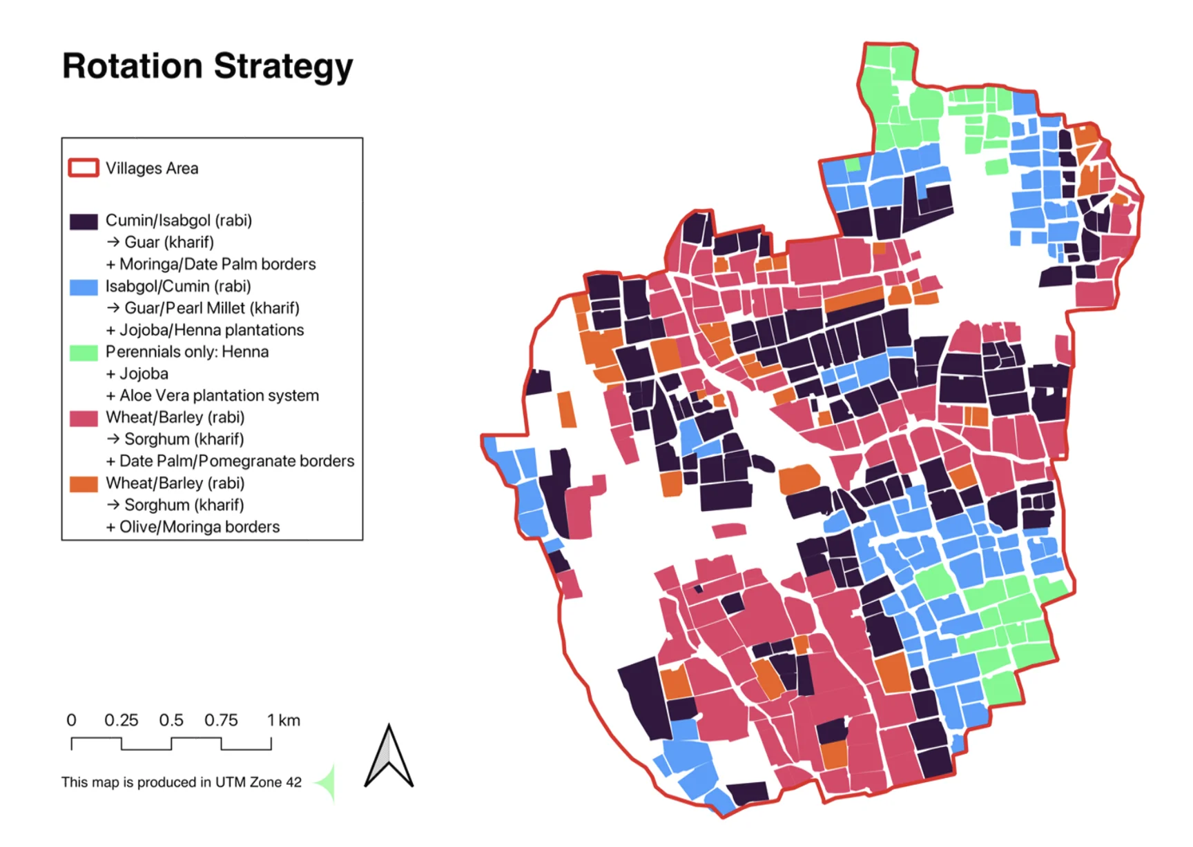
Every field digitised. Every field assigned.
Warayani and Kamacha were mapped parcel by parcel: fields, waterways, settlement, and tree cover. The rotation strategy then assigned crops chosen for yield and profitability in local conditions.
GuarHennaJojobaAloe VeraWheatSorghumMoringaDate Palm
2 villagesmapped in full
Field-leveldigitisation
Season-readyplanting strategy
All projectsNext Project
Guardian Space Early Warning
Guardian Space