AgritechSolutions
Agriculture runs on decisions made before the evidence arrives: what to plant, where, and when. We build the evidence first. Satellite imagery, weather data, and field conditions become crop recommendations, suitability maps, and alerts.
We tell you what's best for your land before you commit a season to it.
Crop suitability analysis
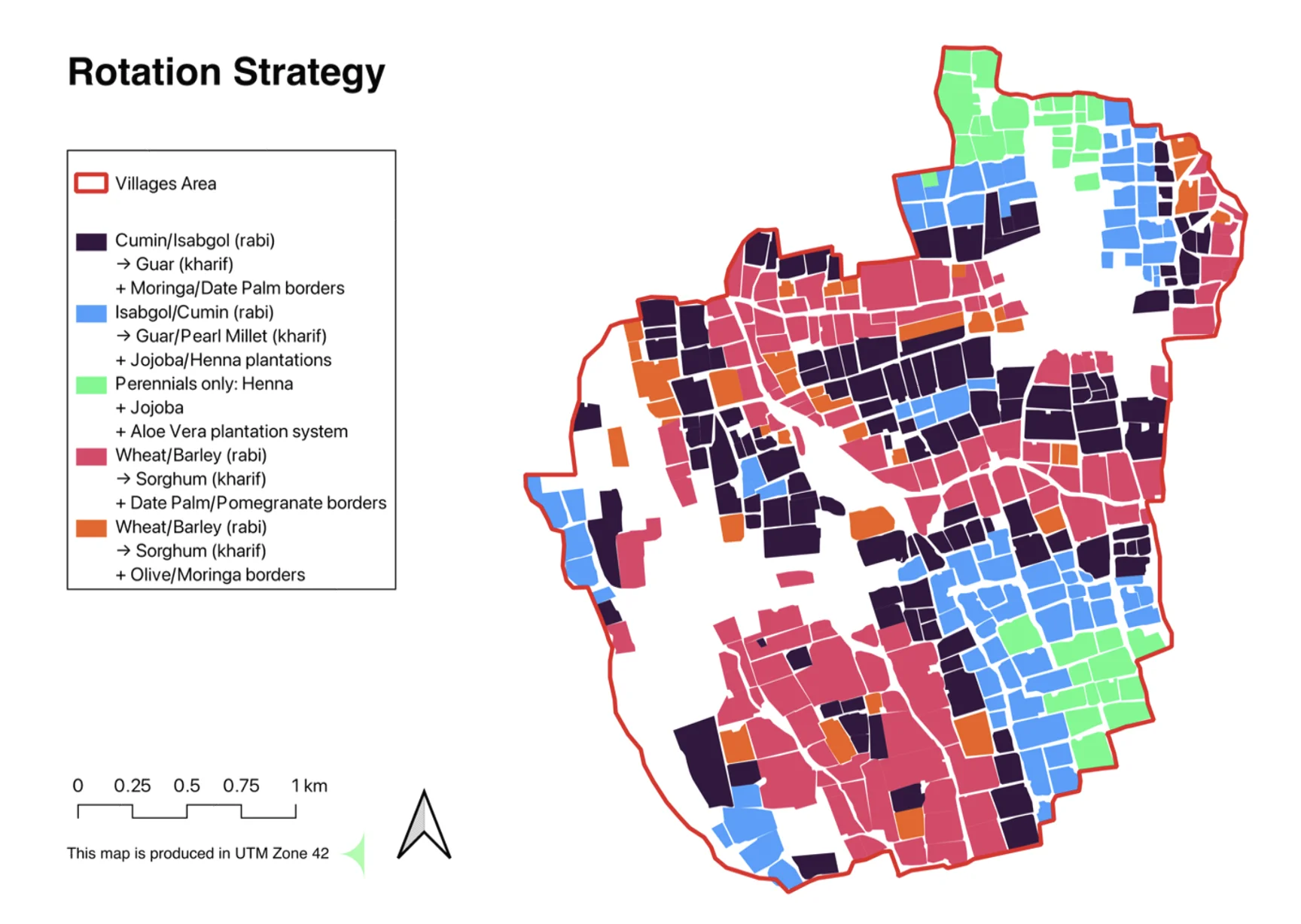
We rank what a given piece of land will actually grow, scored on its own soil, water and climate rather than a regional average. Guar might top the list on one field and fail on the next. The ranking tells you which is which before anything goes in the ground.
Seasonal planting guidance
A good crop planted in the wrong window still loses money. We set timing to seasonal calendars for your area and name the varieties that earn their keep in that soil.
Field-level monitoring
Watch every parcel through the season. When moisture drops, the alert identifies the exact field that needs water or nutrients.
Farmer-facing delivery
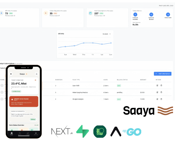
Our app Saaya carries information to the people actually planting. On a phone, in the language they speak locally.
Our Argitech services
- Crop feasibility studies
- Hydroponics feasibility
- Plantation drive planning
- Yield and profitability analysis
- Mangrove restoration siting
- Reforestation methods
- Deforestation studies
- Green cover expansion plans
- Carbon credit groundwork
- Blue economy assessments
- Land use investment cases
An engagement with us runs like this.
Map the baseline: fields, water, settlement, and existing cover
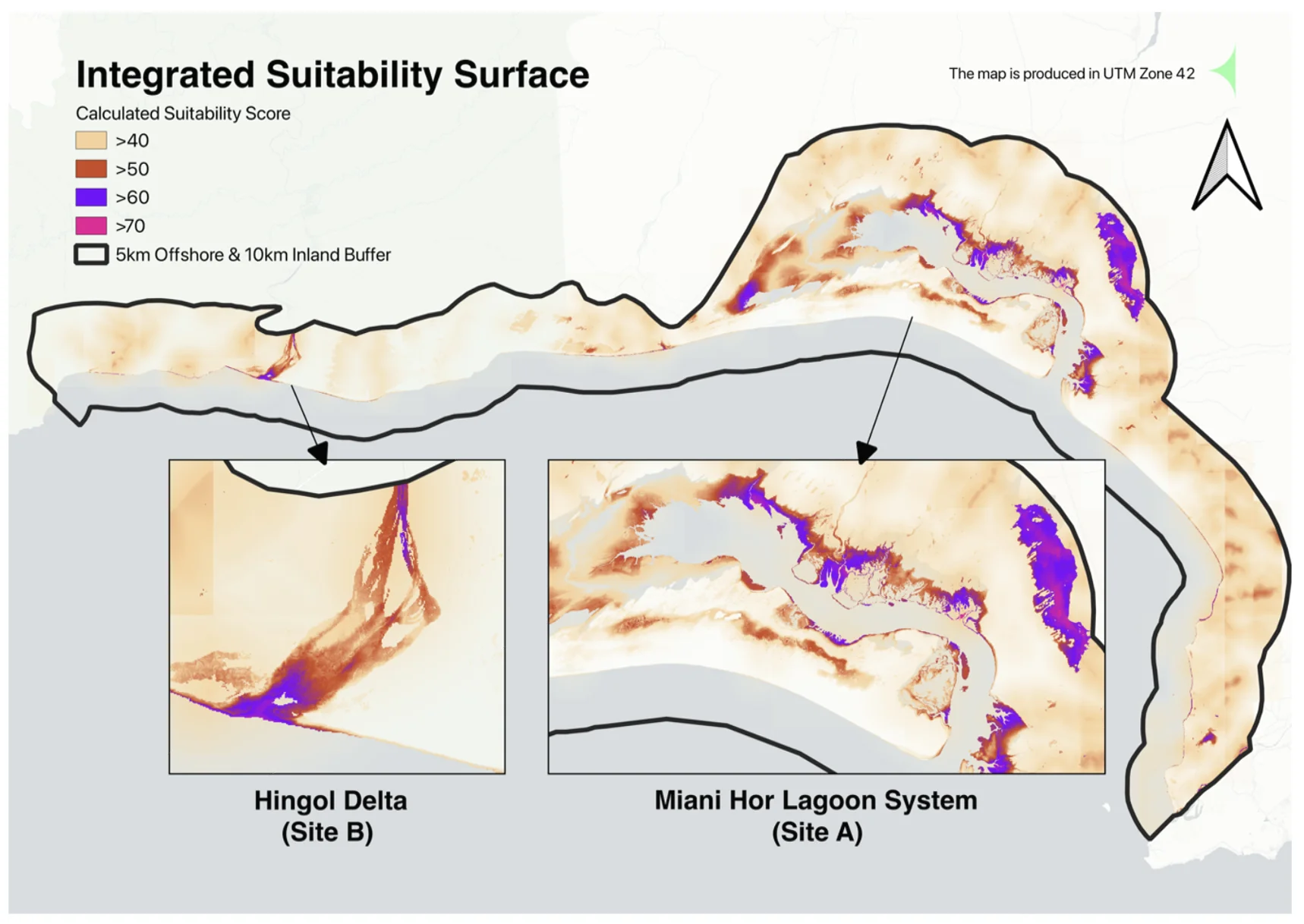
Model suitability and seasonal windows from satellite and climate records
Deliver guidance through dashboards, reports, or farmer-facing apps
Monitor the season and refine the recommendations against outcomes